WorkOutDoors |
|
WorkOutDoors |
|
WorkOutDoors displays a fully functional vector map (just like the maps on the iPhone). The map includes paths, trails, tracks & pistes, making it perfect for outdoor activities.
Maps can be smoothly panned with your finger and zoomed by using the digital crown. They can also be stored offline on your watch for use when there is no data signal. Choose from standard maps or topographic maps with contours and hill shading.
Maps for the whole world are included. There are no subscriptions or extra payments.
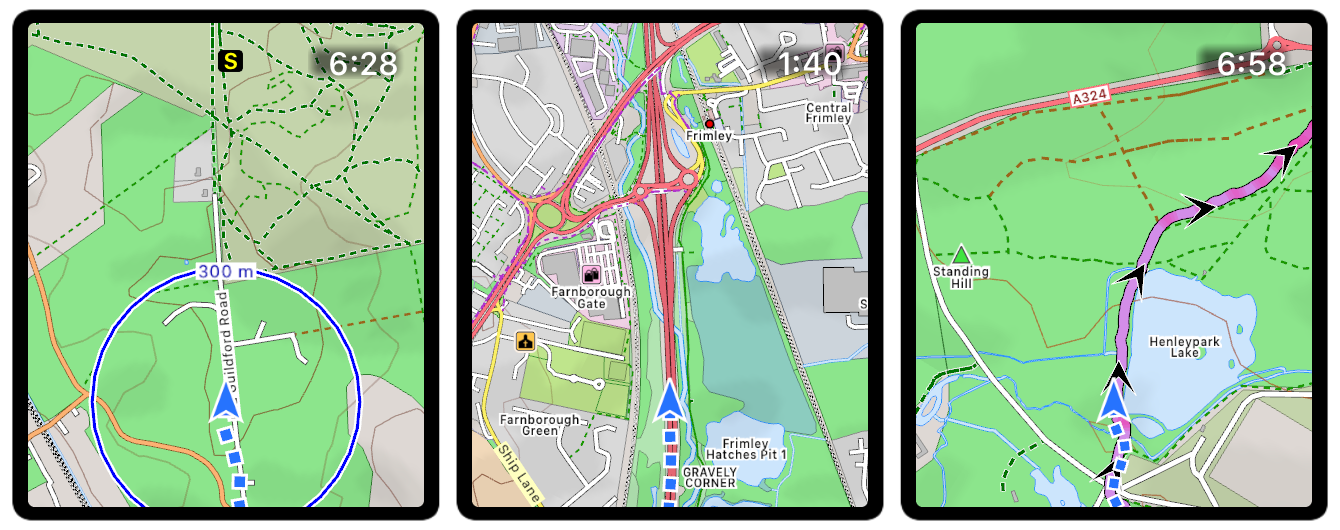
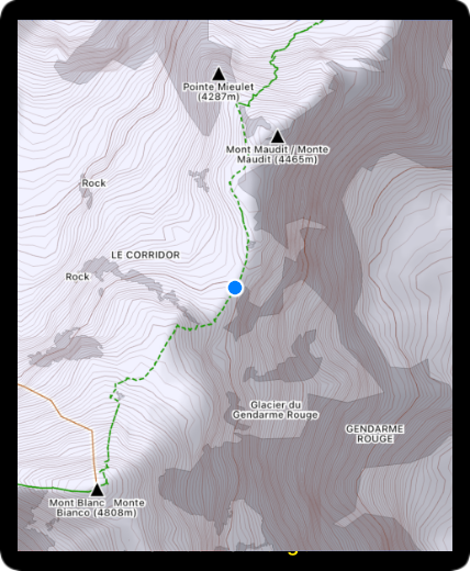
The map can rotate to match the compass (if available) or the direction of travel. When rotating the GPS location is below the centre, to show more detail ahead than behind.
The optional red compass points towards the north. Tap it to turn auto-rotate on or off.
A series of blue dots marks out your whole route. The dots are grey where the GPS signal was poor.
If you pan away from your location, then a Tracking button appears in the bottom left. Tap it to resume tracking.
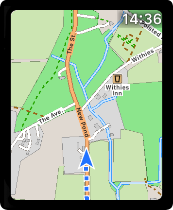
You can use your finger to pan across the map in any direction.
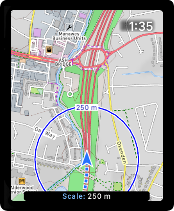
You can zoom in or out by using the digital crown. A scale is shown as you zoom, making it easy to determine how far away places are.
GPX / TCX / FIT routes can be displayed on the map. These can contain turn by turn directions and waypoints. The app also detects climbs and descents on the route and provides information about them during the workout.
See the Navigation section for more information.
The app has the option of topographic maps with contour lines and hill shading to help you read the terrain. To use the topographic maps go to the Map settings in the app.
These settings also allow you to change the colour and opacity of the contours and the opacity of the hill shading.
A map can be displayed without starting a workout. All of the same map functionality is available as when running a workout.
In this mode you can control how long the GPS stays on, to help minimise battery usage.
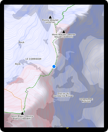
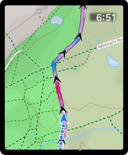
You can configure different colours for contours above you and those below, making it easier to read the terrain.
In the screenshot the contours below you are blue and contours above you are red, so you can easily see that you are on a ridge between a large peak and a smaller peak.
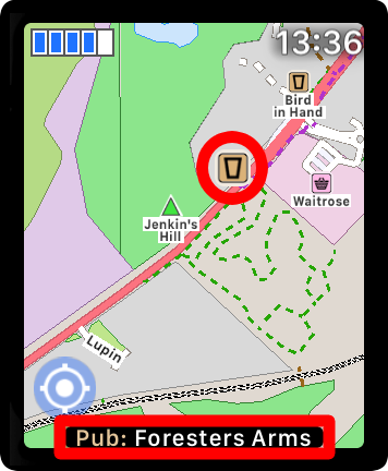
You can create your own waypoints and navigate to them. Or choose a point of interest on the map to navigate to. For example hospitals, cafes, sights etc.
See the Waypoints page for more information.
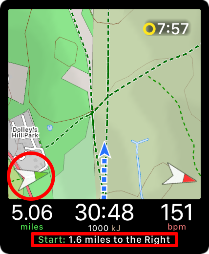
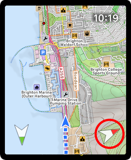
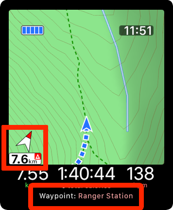
The optional green compass points in the direction of where you started your workout (marked by a green circle).
Tapping the green compass shows the distance to this starting position.
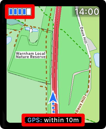
The GPS Signal strength indicator is shown in the top left corner. Double-tap that area to hide it or display it again.
Single tap the indicator to show the exact GPS accuracy at the bottom of the screen.
You can see more information about POIs or road names by simply tapping them.
The POI or name will enlarge to be more visible, and details will be shown temporarily at the bottom of the screen.
There are loads of other features available by tapping or double tapping items.
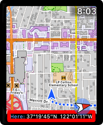
Tap the GPS arrow to see the latitude and longitude. Or tap the time to see it in full, with seconds. Double tap controls to hide or reshow them.
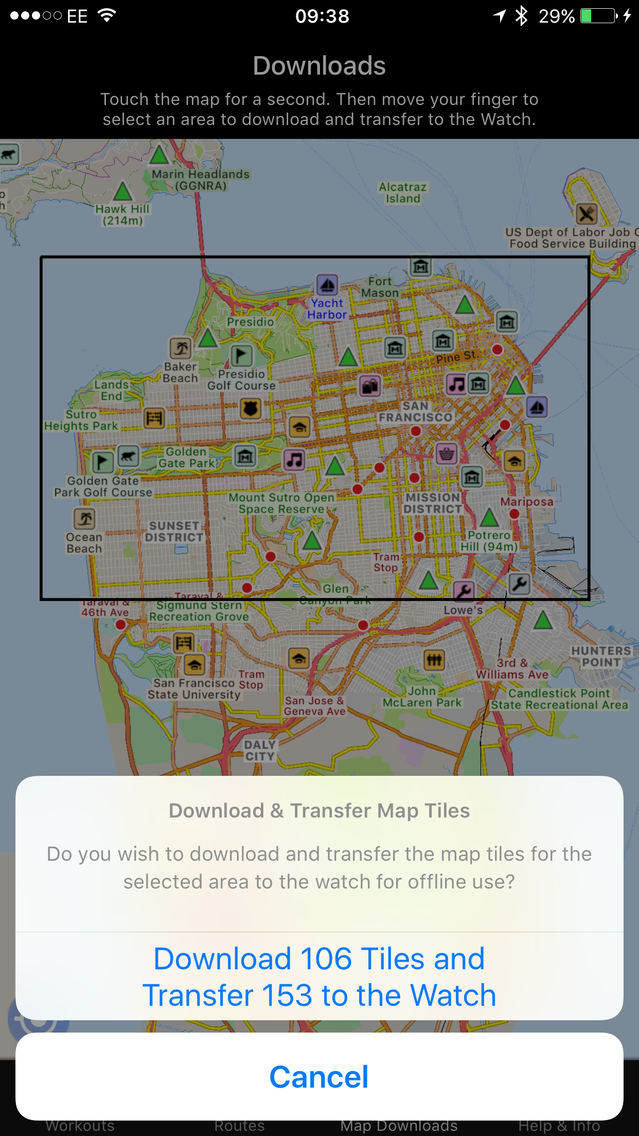
The iPhone app allows areas of the map to be downloaded and transferred to the Apple Watch, for use offline.
This allows you to use the maps even without a data signal, and if you have GPS on the watch then you do not even need to bring your iPhone!
Downloading the maps in this manner also makes them quicker to draw on your watch, because it does not need to download them before drawing.
Email us for more information, or check out our Press Kit or our Privacy Policy.